舆图
恩古鲁 二级行政中心
Nguru · 约贝州
- 国家 / 地区
- 尼日利亚
- 一级行政区
- 约贝州
- 坐标
- 北纬 12.88°,东经 10.46°

示意图,边界据 Natural Earth,不作为划界依据。
更多资料
- 人口(Wikidata)
- 150,699(2006 年)
- 面积
- 916.0 平方千米
- 所属行政区
- 约贝州
气候
平均最高气温日平均气温平均最低气温降水量
| 1月 | 2月 | 3月 | 4月 | 5月 | 6月 | 7月 | 8月 | 9月 | 10月 | 11月 | 12月 | 全年 | |
|---|---|---|---|---|---|---|---|---|---|---|---|---|---|
| 极端最高气温(°C) | 40.0 | 42.1 | 46.6 | 44.4 | 44.5 | 47.5 | 41.9 | 39.2 | 39.8 | 41.5 | 41.4 | 40.5 | — |
| 平均最高气温(°C) | 30.6 | 34.0 | 38.1 | 40.8 | 40.4 | 38.1 | 34.3 | 32.2 | 34.4 | 36.7 | 35.3 | 31.4 | 35.5 |
| 日平均气温(°C) | 22.2 | 25.3 | 29.5 | 32.5 | 33.0 | 31.6 | 29.0 | 27.3 | 28.9 | 29.4 | 26.9 | 23.3 | 28.2 |
| 平均最低气温(°C) | 13.9 | 16.6 | 20.9 | 24.3 | 25.6 | 25.1 | 23.6 | 22.4 | 23.3 | 22.2 | 18.4 | 15.1 | 21.0 |
| 极端最低气温(°C) | 5.0 | 6.0 | 8.0 | 12.0 | 15.0 | 15.9 | 16.0 | 14.0 | 15.0 | 9.8 | 10.0 | 5.0 | 5.0 |
| 降水量(毫米) | 0 | 0 | 0 | 2.8 | 15.1 | 55.6 | 150.8 | 204.1 | 84.2 | 10.5 | 0 | 0 | 523.1 |
| 降水日数(≥1.0 毫米) | 0 | 0 | 0 | 0.3 | 1.8 | 3.9 | 7.8 | 10.4 | 5.9 | 1.4 | 0 | 0 | 31.5 |
| 平均相对湿度(%) | 18.9 | 14.5 | 12.4 | 17.1 | 29.8 | 44.4 | 59.4 | 74.1 | 70.2 | 44.7 | 24 | 21.6 | 35.9 |
数据摘自英文维基百科「Nguru, Nigeria」条目里的气候表,按 CC BY-SA 4.0 使用。原表标题:Nguru (1991–2020)。原表注明的数据来源:NOAA;Deutscher Wetterdienst (extremes)。数据是原表标题写的那一处(多为某个气象站)的,不一定在城区;统计年份见原表标题;以气象部门公布的为准。
百科(英文)
这个词条没有中文维基百科条目,下面是英文维基百科的原文。
Nguru (or N'Gourou) is a town and Local Government Area near the Hadejia River in Yobe State, Nigeria.
It has an area of 916 km2 and a population of 270,632.
The postal code of the area is 630.
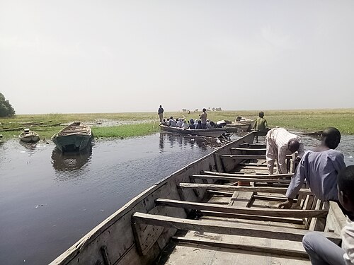
The town probably dates from around the 15th century. There is a variety of landscape types in the area, including the protected Hadejia-Nguru wetlands of Nguru Lake, and the "Sand Dunes", a semi-desert area.
Transport
Nguru is the terminus of the Western Railway of Nigeria.
以上摘自英文维基百科「Nguru, Nigeria」(去掉了表格、图片、参考文献和外部链接),按 CC BY-SA 4.0 使用。