舆图

资料
- 所在国家 / 地区
- 日本
- 坐标
- 北纬 34.17°,东经 135.91°
- 所属山脉
- 大峰山脉
- 属于
- 日本百名山、100 Famous Kansai Mountains、Nara 100 Mountains
- 所在保护区
- 吉野熊野国立公园
灰色斜体的是 Wikidata 里没有中文名的,照录英文名。
百科(英文)
这个词条没有中文维基百科条目,下面是英文维基百科的原文。
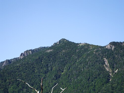
Mount Hakkyō (八経ヶ岳, Hakkyō-ga-take) is a mountain within the Omine Mountains, which are located on the border of Tenkawa and Kamikitayama, Yoshino District, Nara Prefecture, Japan. At 1,914.6 m (6,281 ft), it's the tallest mountain in the in Nara Prefecture and Kansai region.
Overview
In Japanese, ‘Hakkyō’, literally means ‘eight Buddhist scriptures’. This definition is derived from a legend about the believed founder of Shugendo, En no Gyōja, burying eight Buddhist scriptures on the top of the mountain. The mountain is also called Hakken-zan, literally ‘mountain of eight swords’ or Bukkyō-ga-take, also literally ‘mountain of Buddhist scriptures’. Sometimes, the mountain is mistaken for Mount Omine.
Multiple primeval forests on Mount Yatsugatake have been designated as national natural monuments and are registered as UNESCO World Heritage sites in the "Sacred Sites and Pilgrimage Routes in the Kii Mountain Range" (registered in July 2004) .
Bukkyogatake Primeval Forest - a primeval forest including pure Abies veitchii forests and spruce forests (designated October 12, 1922 (Taisho 11))
Sacred magnolia habitat (designated February 7, 1928 (Showa 3))
Routes
The mountain has several routes to the summit. The easiest is from Gyojamodori-Tunnel-Nishi-guchi, taking about three hours. The traditional route is from Tenkawa-Kawai, a seven-hour journey.
Reception
The mountain was listed in the book 100 Famous Japanese Mountains by Kyūya Fukada.
In popular culture
The mountain appeared in Assassin's Creed Shadows.
以上摘自英文维基百科「Mount Hakkyō」(去掉了表格、图片、参考文献和外部链接),按 CC BY-SA 4.0 使用。