舆图

示意图,边界据 Natural Earth,不作为划界依据。
资料
百科(英文)
这个词条没有中文维基百科条目,下面是英文维基百科的原文。
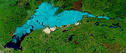
Utikuma Lake is a large lake in north-central Alberta, Canada. It is located 30 km (19 mi) north of the Lesser Slave Lake, between the Bicentennial Highway and Highway 750.
It has a total surface of 288 km2 (111 sq mi) with 15.3 km2 (5.9 sq mi) island area. The shallow lake (maximum depth is 5.5 m (18 ft)) lies at an elevation of 648 m (2,126 ft). It is drained by the Utikuma River and then Wabasca River to Peace River.
The name Uticuma is Cree for "big whitefish".
The Utikoomak Lake 155 indian reserve of the Whitefish Lake First Nations is established on the northern shore.
以上摘自英文维基百科「Utikuma Lake」(去掉了表格、图片、参考文献和外部链接),按 CC BY-SA 4.0 使用。