舆图

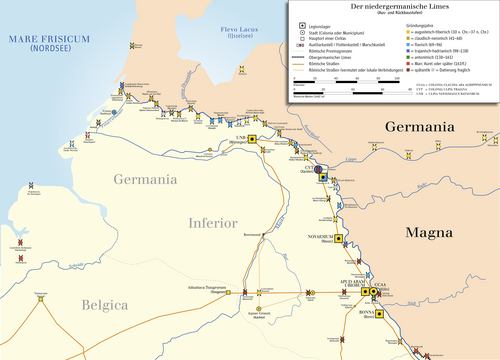
The Lower Germanic Limes (Latin: limes ad Germaniam inferiorem, Dutch: Neder-Germaanse Limes, German: Niedergermanischer Limes) is the former frontier between the Roman province of Germania Inferior and Germania Magna. The Lower Germanic Limes separated that part of the Rhineland west of the Rhine as well as the southern part of the Netherlands, which was part of the Roman Empire, from the less tightly controlled regions east of the Rhine.
摘自英文维基百科「Lower Germanic Limes」,按 CC BY-SA 4.0 使用
资料