舆图

资料
百科(英文)
这个词条没有中文维基百科条目,下面是英文维基百科的原文。
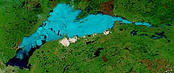
Keller Lake is a surface water body in the Northwest Territories of Canada. It is located 85 kilometers (53 mi) south of the Great Bear Lake and 220 kilometers (140 mi) north of Fort Simpson, at an elevation of 255 meters (837 ft). The lake has a triangular shape, a surface area of 380 square kilometers (150 sq mi), and it empties through the Johnny Hoe River into the Great Bear Lake.
There is a salmonid population in Keller Lake. On some of the plains surrounding Keller Lake, climax polygonal bogs have formed, the early successional stage to which often consists of pioneer Black Spruce.
以上摘自英文维基百科「Keller Lake」(去掉了表格、图片、参考文献和外部链接),按 CC BY-SA 4.0 使用。