舆图

资料
- 所在国家 / 地区
- 巴西
- 坐标
- 南纬 19.66°,西经 39.81°
- 发源地
- 曼蒂凯拉山脉
- 注入
- 大西洋
- 支流
- Piracicaba River、Guandu River、Santo Antônio River、Pancas River、Ipanema Stream、Sacramento Stream、Caratinga River、Casca River、Corrente River、Rio Laje、Manhuaçu River、Matipó River、Santa Joana River、Santa Maria do Rio Doce River、Suaçuí Grande River、Suaçuí Pequeno River、Do Carmo River、Boi Stream、São José River
百科(英文)
这个词条没有中文维基百科条目,下面是英文维基百科的原文。
The Doce River (Portuguese: Rio Doce [ˈʁi.u ˈdos(i)], "Sweet River") is a river in southeast Brazil with a length of 853 kilometres (530 mi).
The river basin is economically important. In 2015, the collapse of a dam released highly contaminated water from mining into the river, causing an ecological disaster.
Course
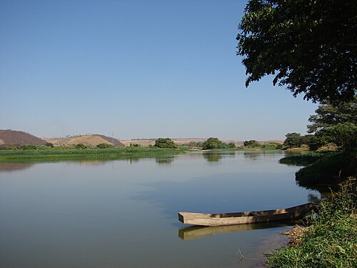
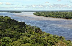
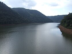
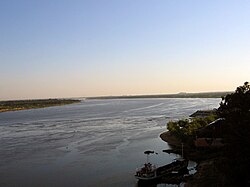
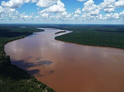
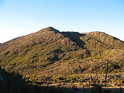
The Doce River is formed by the junction of the Piranga and the Carmo near the historical city of Ouro Preto, whose sources are located in the foothills of the Mantiqueira and Espinhaço mountain chains at altitudes of about 1,200 m (3,937 ft). It flows in a northeastern direction via Ipatinga, makes a wide curve near Governador Valadares, and flows in a southeastern direction passing through Conselheiro Pena, to enter the Atlantic Ocean near Linhares in Espírito Santo state. Its main tributaries are the Piracicaba, Casca, Matipó, Caratinga-Cuieté, Manhuaçu, Santo Antônio and Suaçuí Grande, in Minas Gerais; the Pancas, Guandu, and São José, in Espírito Santo.
Part of the river basin is contained in the 3,562 hectares (8,800 acres) Augusto Ruschi Biological Reserve, a fully protected area.
South of the point where the Piracicaba enters the river near Ipatinga the river forms the eastern boundary of the Rio Doce State Park.
Economic value
The Doce River has great economic importance for the region. The basin is home to the largest steel making complex in Latin America. Three of the five largest companies in Minas Gerais state in the year 2000, Companhia Siderúrgica Belgo Mineira, Arcelor Mittal (Acesita) and Usiminas, are located there. The largest open-pit mine in the world is operated in the basin by the Companhia Vale do Rio Doce. These industrial conglomerates have an important role in Brazilian exports of iron ore, steel, and cellulose (Cenibra). In addition, the Doce basin contributes greatly to production of coffee from Minas Gerais and Espírito Santo as well as fruit pulp from Espírito Santo.
Fifteen percent of the GDP of the state of Minas Gerais is produced in the region with the municipality of Ipatinga accounting for 5.4% of that total. Ipatinga is the major city of the Vale do Aço Metropolitan Area.
The economy of the basin is based on the following activities:
agriculture: dairy and beef cattle, pig raising, coffee, sugar cane, fruits and vegetables and cocoa;
industry: siderurgy, metallurgy, mechanical, chemical, food, alcohol, textile, leather, paper and paper pulp; and
mining: iron, gold, bauxite, manganese, and precious stones.
According to the Anuário Estatístico do Brasil (IBGE) the Doce basin has a population of about 3,100,000, with the urban population making up 68.7% of the total population. In recent years the population has declined, with small towns and rural areas losing up to 40% of their population.
Major cities located along the Doce or in its basin are: Timóteo, Coronel Fabriciano, Ipatinga, Governador Valadares, Colatina, and Linhares.
Climate
According to the Koppen classification, there are three climatic types in the Doce basin:
Tropical with altitude climate with summer rains and cool summers, present on the slopes of the Mantiqueira and the Espinhaço Mountains and at the sources of the Doce river.
Tropical with altitude climate with summer rains and hot summers, present at the sources of its tributaries.
Hot climate with summer rains, present in the middle and lower sections of the Doce and its tributaries.
Demographics
According to the Comitê da Bacia Hidrográfica do Rio Doce (CBH-Doce), the Doce River basin covers all or part of 229 municipalities, of which 203 are in Minas Gerais and 26 in Espírito Santo. Of the total, 211 have their municipal seat located in the basin area, which has a population of more than 3.6 million inhabitants. The number of municipalities varies according to the source, and the National Water and Basic Sanitation Agency (ANA) considers 225 municipalities. The most populous are Governador Valadares and Ipatinga, both in Minas Gerais, which together concentrate over 540,000 inhabitants. Other municipalities with more than 100,000 inhabitants are Coronel Fabriciano, Itabira, and Ubá in Minas Gerais and Colatina, Linhares, and São Mateus in Espírito Santo.
A total of 38 municipalities are bathed by the Doce River, considering it from the confluence of the Piranga and Carmo rivers onward, 34 of them in Minas Gerais and four in Espírito Santo. Of these, Ipatinga, Governador Valadares, Colatina, and Linhares are the most populous cities on the banks. However, the municipalities of Coronel Fabriciano, Ipatinga, Santana do Paraíso, and Timóteo make up the Vale do Aço Metropolitan Region, which is the greatest population concentration in the basin. Together with its metropolitan collar the cities form a network of more than 778,000 inhabitants, according to 2021 estimates. Of the total residents of the Doce River basin, about 70% inhabit urban areas. The concentration in urban areas is directly linked to the rural exodus generated by the process of industrialization and development of the main cities, but more than 100 municipalities still have a rural population larger than the urban one. The most important federal highways crossing the region are BR-381, BR-116, BR-262, BR-101, BR-259, and BR-458.
About 51% of all water extracted directly from the Doce River basin is intended for irrigation, 22% for urban supply, 17% for industries, 7% for animal watering, and 4% for rural supply. According to 2010 information, the total exploited to meet demands is equivalent to 29.733 cubic meters per second (m³/s), a value that was considered to be within the limits of the United Nations (UN), comparing it with availability. However, the demand for human and industrial consumption is significantly increasing, at the same time that ever more intense droughts and environmental degradation have reduced water availability. The sub-basin of the Santa Joana River, in Espírito Santo, already shows a situation classified as "concerning".
Direct use of the waters
Fishing is still present in the Doce River, although the fish population of some species has decreased over time due to the impacts caused by human action.
Ecology and environment
Degradation
At the same time that the area covered by native forest is broken up into isolated non-devastated patches, the Doce River and its tributaries are heavily affected by pollution generated by waste arising from the activities of local industries, urban sewage, rampant deforestation, mining, and excessive manipulation of its waters. Industrial and urban contamination, associated with the absence of environmental control, made the Doce River the tenth most polluted river in Brazil according to the Social Development Index (IDS) calculated by the Brazilian Institute of Geography and Statistics (IBGE) in 2011, therefore even before the dam collapse in Mariana in 2015. In 2014, the basin was identified as the most degraded in Minas Gerais.
In the urban context
According to information from 2019, the Doce River receives the sewage discharged by at least 80% of the cities located on its banks without any type of treatment. The same percentage of municipalities in the basin also lack wastewater treatment, and pollution in the tributaries directly affects the main course. In several stretches along the entire watercourse and its tributaries, the presence of pollutants originating from sewage is sufficient to make the waters unsuitable for irrigation and for animal or human consumption, a situation that affects the population's living and health conditions and the transmission of diseases.
An analysis commissioned by Estado de Minas, released in April 2014, shows that the waters of the Piranga River had 1200% more fecal coliforms than permitted by the National Council for the Environment (CONAMA) after leaving the city of Ponte Nova and before meeting the Carmo River to form the Doce River. In Ipatinga the concentration was 40% higher than the limit, while in Governador Valadares it reached 240%. At the confluence of the Piranga and Carmo rivers, the presence of thermotolerant coliforms was 5172% above the acceptable level. Governador Valadares, the most populous city on the Doce River, had all sewage from the urban area discharged into the watercourse without any treatment according to information from 2021, although treatment plants had been under construction since 2014. At the same time, the riverbed was the main source of supply for the public network, but a new water intake source was being built from the Corrente Grande River. Contamination extends as far as the Atlantic Ocean, with records of fecal coliforms in the river mouth region transported through the watercourse.
Pollution of the watercourse was aggravated by the long period of irregular rainfall that the region experienced throughout the 2010s, leading to a considerable decrease in its average level and the disappearance of springs in the basin.
以上摘自英文维基百科「Doce River」(有删节;去掉了表格、图片、参考文献和外部链接),按 CC BY-SA 4.0 使用。全文和最新版本请看原文。