舆图

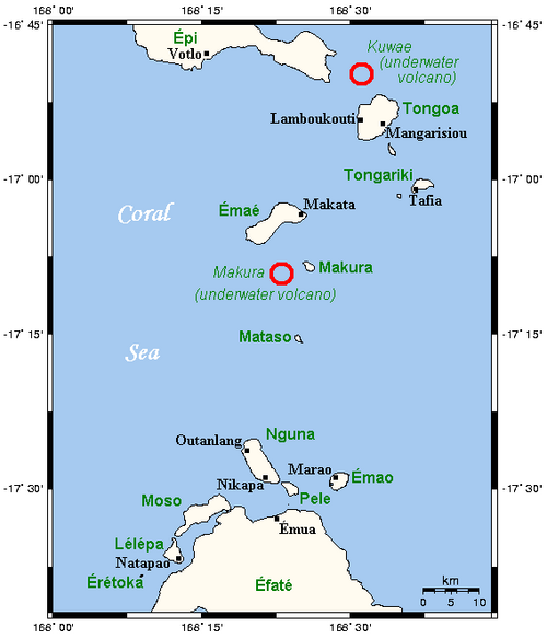
Kuwae was a landmass that existed in the vicinity of Tongoa and was destroyed by volcanic eruption in the fifteenth century, probably through caldera subsidence. Its exact location is debated. A submarine caldera now known as the Kuwae caldera is a candidate, located between the Epi and Tongoa islands and cutting through the flank of the Tavani Ruru volcano on Epi and the northwestern end of Tongoa. Another candidate is a proposed caldera between Tongoa and Tongariki.
摘自英文维基百科「Kuwae」,按 CC BY-SA 4.0 使用
资料
- 所在国家 / 地区
- 瓦努阿图
- 坐标
- 南纬 16.83°,东经 168.54°