舆图

示意图,边界据 Natural Earth,不作为划界依据。
资料
百科(英文)
这个词条没有中文维基百科条目,下面是英文维基百科的原文。
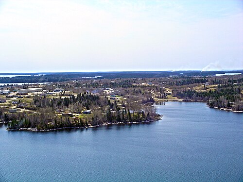
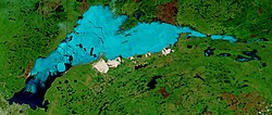
Island Lake is a lake in northeastern Manitoba in Canada, near the Ontario border. The lake covers a total area of 1,223 square kilometres (472 sq mi), making it the 6th largest lake in the province. The lake is in the Hayes River drainage basin. The Island Lake River flows north from the northwest section of the lake into Gods Lake via Goose Lake and Beaver Lake. Gods Lake drains north through Gods River into the Hayes River.
Legal significance
A monument at the east end of the lake is a key point in the demarcation of the northeast–southwest boundary between Ontario and Manitoba. Contrary to popular belief, this part of the inter-provincial border is not a mere straight line from the northeast corner of Manitoba's pre-1912 border to Hudson Bay. Instead, the Manitoba Boundaries Extension Act, 1912 and the Ontario Boundaries Extension Act, 1912 define a corner at the east end of Island Lake (where the monument now sits) and from where the border continues to run in a slightly more north-south direction until it intersects with Hudson Bay at 89th meridian west.
Settlements
Located on the lake are the First Nations communities of Wasagamack, St. Theresa Point and Garden Hill and the northern settlement of Island Lake which in 2011 had a combined population of 7,120.
Wasagamack had a population of 1,411 in the Canada Census of 2011 and St. Theresa Point had 2,871. Both are located on the western side of the lake. About 18 km (11 miles) east across the bay are Garden Hill with a population of 2,776 and nearby Island Lake with 62 residents. The northern settlement of Island Lake is located on several islands.
以上摘自英文维基百科「Island Lake (Manitoba)」(去掉了表格、图片、参考文献和外部链接),按 CC BY-SA 4.0 使用。