舆图

资料
- 所在国家 / 地区
- 美国
- 坐标
- 北纬 37.89°,西经 110.70°
- 所属山脉
- 亨利山脉
百科(英文)
这个词条没有中文维基百科条目,下面是英文维基百科的原文。
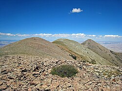
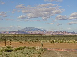
Mount Hillers is a summit in the Henry Mountains range, in Garfield County, Utah, in the United States. Its elevation is 10,741 feet (3,274 m) NAVD 88.
It was named by Almon Harris Thompson for John Karl Hillers, a government photographer.
Climate
Spring and fall are the most favorable seasons to visit Mount Hillers. According to the Köppen climate classification system, it is located in a Cold semi-arid climate zone, which is defined by the coldest month having an average mean temperature below 32 °F (0 °C), and at least 50% of the total annual precipitation being received during the spring and summer. This desert climate receives less than 10 inches (250 millimeters) of annual rainfall, and snowfall is generally light during the winter.
以上摘自英文维基百科「Mount Hillers」(去掉了表格、图片、参考文献和外部链接),按 CC BY-SA 4.0 使用。