舆图

资料
- 所在国家 / 地区
- 加拿大
- 坐标
- 北纬 53.14°,西经 119.26°
- 所属山脉
- 帕克山脉
百科(英文)
这个词条没有中文维基百科条目,下面是英文维基百科的原文。
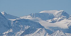
Whitehorn Mountain is a 3,399-metre (11,152 ft) peak located in eastern British Columbia, Canada near the Alberta border. It is one of British Columbia's 102 ultra prominent peaks.
Whitehorn Mountain was first climbed by Conrad Kain in a rare solo ascent for him. Kain was in the Mount Robson area guiding a reconnaissance party led by Arthur Wheeler in 1911 when he completed the solo ascent, much to the disgruntlement of Wheeler.
Climate
Based on the Köppen climate classification, Whitehorn Mountain is located in a subarctic climate zone with cold, snowy winters, and mild summers. Winter temperatures can drop below -20 °C with wind chill factors below -30 °C.
以上摘自英文维基百科「Whitehorn Mountain (British Columbia)」(去掉了表格、图片、参考文献和外部链接),按 CC BY-SA 4.0 使用。