舆图

资料
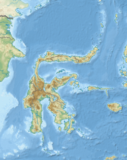
- 所在国家 / 地区
- 印度尼西亚
- 坐标
- 南纬 1.83°,东经 124.83°
- 属于
- 苏拉群岛
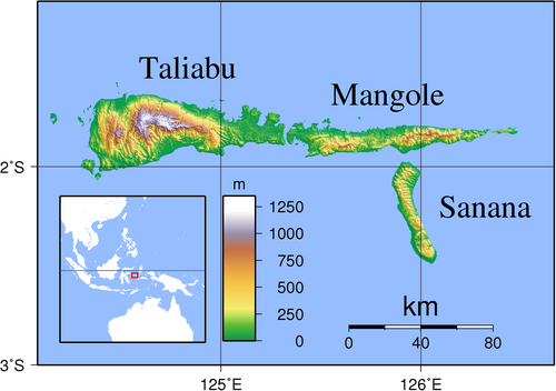
Taliabu Island Regency (Indonesian: Kabupaten Pulau Taliabu) is a regency in the North Maluku province of Indonesia, consisting primarily of the island of Taliabu, the most western, geographically, of the Sula Archipelago. It is located to the west of Mangole Island and Sanana Island, the two islands which remain part of the former Sula Islands Regency; until 14 December 2012, when it was administratively-separated into its own regency, Taliabu had been a part of the Sula Islands Regency. Presently, Taliabu Island Regency (including minor offshore islands, predominantly to the west and southwe……
摘自英文维基百科「Taliabu」,按 CC BY-SA 4.0 使用