舆图

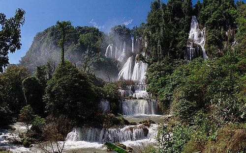
The Thi Lo Su Waterfall (Thai: น้ำตกทีลอซู, RTGS: Namtok Thi Lo Su; S'gaw Karen: ထံလီၤဆူ, also spelt as Thee Lor Sue, The Lor Sue, Thee Lor Sue or Te-law-zue; lit: Black Waterfall) is claimed to be the largest and highest waterfall in Thailand. It stands 250 metres (820 ft) high and nearly 450 metres (1,480 ft) wide on the Mae Klong River, flowing down from Huai Klotho into the Umphang Wildlife Sanctuary in Tak Province in northwestern Thailand.
摘自英文维基百科「Thi Lo Su Waterfall」,按 CC BY-SA 4.0 使用
资料
- 所在国家 / 地区
- 泰国
- 坐标
- 北纬 15.93°,东经 98.75°