舆图

资料
百科(英文)
这个词条没有中文维基百科条目,下面是英文维基百科的原文。
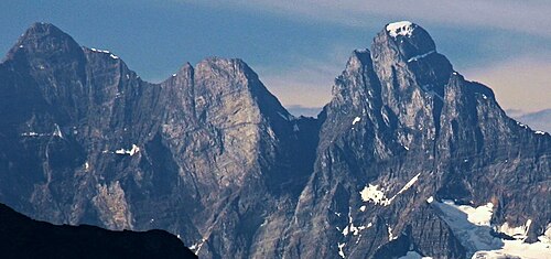
Mount Goodsir (or the Goodsir Towers) is the highest mountain in the Ottertail Range, a subrange of the Park Ranges in British Columbia. It is located in Yoho National Park, near its border with Kootenay National Park. The mountain has two major summits, the South Tower (the higher summit) and the North Tower, 3,525 metres (11,565 ft).
The mountain was named by James Hector in 1859 after two brothers, John Goodsir, a professor of anatomy at the University of Edinburgh, and Harry Goodsir, a surgeon on the ship HMS Erebus.
The standard route on the South Tower is the southwest ridge, a straightforward but long climb (Grade III), which consists primarily of non-technical terrain, but includes short sections of narrow ridge graded YDS 5.4. Access to any route on either Tower requires a long hike.
以上摘自英文维基百科「Mount Goodsir」(去掉了表格、图片、参考文献和外部链接),按 CC BY-SA 4.0 使用。