舆图

资料
- 所在国家 / 地区
- 美国
- 坐标
- 北纬 31.85°,西经 109.29°
- 所属山脉
- 奇里卡瓦山脉
百科(英文)
这个词条没有中文维基百科条目,下面是英文维基百科的原文。
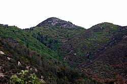
Chiricahua Peak is a 9,773-foot (2,979 m) peak located in the Chiricahua Mountains of southeastern Arizona, located about 35 miles (56 km) north of the United States–Mexico border. It is the highest summit in the Chiricahua Mountains and the highest point in Cochise County.
As with the rest of the Chiricahua Mountains, the peak was formed as the result of a violent volcanic eruption about 27 million years ago.
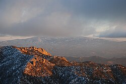
The peak contains one of the southernmost Engelmann spruce stands in the world. There are also extensive stands of quaking aspen on the north slope. Much of the peak was severely burned in recent times, causing aspens to take up once occupied by evergreen trees. Through the trunks of trees, views can be seen northward and westward. This includes views across the Basin and Range to Mount Lemmon, Mount Graham, and Mount Wrightson. In addition, Willcox Playa is visible in the basin below.
In 2011 the Horseshoe 2 Fire burned a total of 223,000 acres (90,000 ha) within the Chiricahua Mountains causing considerable damage to the trail system. Most trails still receive infrequent volunteer maintenance.
以上摘自英文维基百科「Chiricahua Peak」(去掉了表格、图片、参考文献和外部链接),按 CC BY-SA 4.0 使用。