舆图

资料
- 所在国家 / 地区
- 美国
- 坐标
- 北纬 40.01°,西经 107.08°
百科(英文)
这个词条没有中文维基百科条目,下面是英文维基百科的原文。
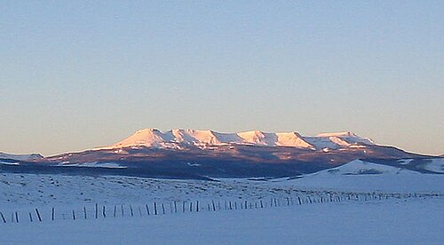
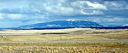
Flat Top Mountain is the highest summit of the Flat Tops in the Rocky Mountains of North America. The prominent 12,361-foot (3,768 m) peak is located in the Flat Tops Wilderness, 19.1 miles (30.7 km) south-southwest (bearing 201°) of the Town of Oak Creek, Colorado, United States, on the drainage divide between Routt National Forest and White River National Forest. The summit of Flat Top Mountain is the highest point in Garfield County, Colorado.
Climate
Flat Top Mountain has a subalpine climate (Köppen Dfc), bordering on an alpine climate (ETH), with only one month averaging over 50 °F (10 °C).
以上摘自英文维基百科「Flat Top Mountain (Colorado)」(去掉了表格、图片、参考文献和外部链接),按 CC BY-SA 4.0 使用。