舆图

资料
百科(英文)
这个词条没有中文维基百科条目,下面是英文维基百科的原文。
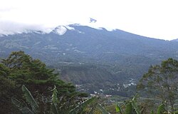
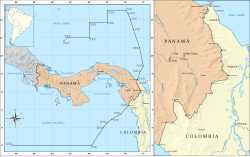
Cerro Tacarcuna is a mountain located in the Darién Province of Panama, very close to the Colombia–Panama border. With a height of 1,875 m (6,152 ft) above sea level, it is the highest point in the Serranía del Darién.
Overview
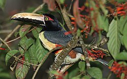
The tropical forests of Cerro Tacarcuna are recognized for their extremely high biodiversity and for presenting a large number of endemisms. They are protected by the Darién National Park and the Los Katíos National Park in Colombia and Panama respectively.
According to Kuna mythology, this ethnic group considers that the Cerro Tacarcuna, or Dakarkunyala in the Tule language, is the original place of origin and that from there they spread throughout the Darién and the San Blas archipelago (Caribbean Sea, in Panama); the hill is 1,875 meters above sea level.
以上摘自英文维基百科「Cerro Tacarcuna」(去掉了表格、图片、参考文献和外部链接),按 CC BY-SA 4.0 使用。