舆图

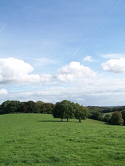
The South Downs are a range of chalk hills that extends for about 260 sq mi (670 km2) across the south-eastern coastal counties of England. This area of downland extends from the Itchen Valley of Hampshire in the west to Beachy Head, in the Eastbourne Downland Estate of East Sussex, in the east. The Downs are bounded on the northern side by a steep escarpment, from whose crest there are extensive views northwards across the Weald (which on its other side is bordered by the North Downs). The South Downs National Park forms a much larger area than the chalk range of the South Downs, and includes……
摘自英文维基百科「South Downs」,按 CC BY-SA 4.0 使用
资料
- 所在国家 / 地区
- 英国
- 坐标
- 北纬 50.90°,西经 0.50°