舆图

资料
- 所在国家 / 地区
- 印度
- 坐标
- 北纬 27.94°,东经 92.67°
- 所属山脉
- Eastern Himalaya
- 属于
- Assam Himalaya
百科(英文)
这个词条没有中文维基百科条目,下面是英文维基百科的原文。
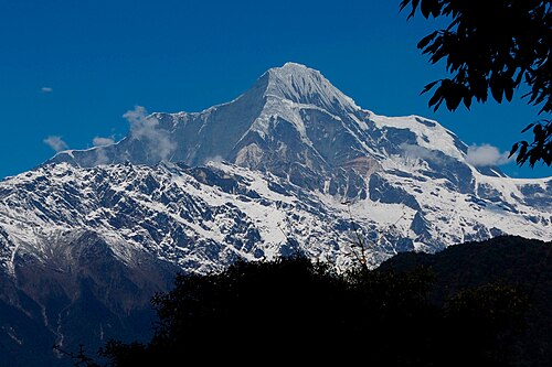
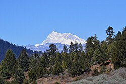
Nyegyi Kangtsang (Puroik: Katoie Gyang; Nyishi: Kra-Daadi) is a mountain of the Eastern Himalayas located in East Kameng district of Arunachal Pradesh state of India on the border with Tibet.
Location
The peak is referred to as Katoie Gyang by the Puroik people and Kra-Daadi or Wapra Kra-Daadi by Nyishi tribes in East Kameng district of Arunachal Pradesh. It has an elevation of 7,047 m (23,120 ft).
Katoie Gyang is one of the highest mountains in Arunachal Pradesh. The Kameng or Kaming (as referred to by Nyishi people) or Katoie Kwa Pi as referred to by Puroik people, is one of the most important rivers in Arunachal Pradesh. The Kameng or Katoie Kwa Pi is fed by several glaciers such as Katoie Gyang Glacier on the eastern flank of Katoie Gyang. The northern flank of the mountain is drained by the Subansiri. It is one of the three major peaks of the Kangto massif.
Climbing history
On October 23, 1995, a five-member Indian expedition led by MP Yadav claimed to have succeeded in the first ascent of the Nyegi Kantsang over the northeast ridge. However, it was later found that the team reached a point about 600 metres below the main summit, and the peak is still unclimbed.
以上摘自英文维基百科「Nyegyi Kansang」(去掉了表格、图片、参考文献和外部链接),按 CC BY-SA 4.0 使用。