舆图

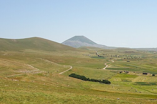
Mount Tavkvetili (Georgian: თავკვეთილი) is a volcanic mountain in the northern part of the Abul-Samsari Range in the Samtskhe-Javakheti and Kvemo Kartli region of Southern Georgia. It is also known as Gora Tavk'vetili and Mta Tavk'vetili. The elevation of the mountain is 2,583 metres (8,474 ft) above sea level and is the 323rd highest mountain in Georgia. The mountain has the shape of a decapitated cone and is composed of young andesitic and andesitic-dacitic lavas. The lower slopes of Mount Tavkvetili are covered by subalpine meadows while the upper slopes are covered by alpine meadows.
摘自英文维基百科「Tavkvetili」,按 CC BY-SA 4.0 使用
资料
- 所在国家 / 地区
- 格鲁吉亚
- 坐标
- 北纬 41.68°,东经 43.72°
- 所属山脉
- Samsari Range