舆图

资料
- 所在国家 / 地区
- 美国
- 坐标
- 北纬 44.67°,西经 121.80°
- 所属山脉
- Oregon Cascades
- 得名自
- 托马斯·杰斐逊
百科(英文)
这个词条没有中文维基百科条目,下面是英文维基百科的原文。
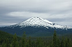
Mount Jefferson is a stratovolcano in the Cascade Volcanic Arc, part of the Cascade Range in the U.S. state of Oregon. The second highest mountain in Oregon, it is situated within Linn County, Jefferson County, and Marion County and forms part of the Mount Jefferson Wilderness. Due to the ruggedness of its surroundings, the mountain is one of the hardest volcanoes to reach in the Cascades. It is also a popular tourist destination despite its remoteness, with recreational activities including hiking, backpacking, mountaineering, and photography. Vegetation at Mount Jefferson is dominated by Douglas fir, silver fir, mountain hemlock, ponderosa pine, lodgepole pine, and several cedar species. Carnivores, insectivores, bats, rodents, deer, birds, and various other species inhabit the area.
Also known as Seekseekqua by Native American populations, the volcano was named after United States President Thomas Jefferson, and was first ascended by E. C. Cross and R. L. Farmer in 1888. It sits atop an area of crustal melting, and was produced by the subduction of the oceanic Juan de Fuca tectonic plate under the continental North American tectonic plate, forming about 730,000 years ago. Consisting of basaltic andesite, andesite, and dacite, the mountain has been extensively altered by glacial erosion. The surrounding area contains a number of other volcanic features like cinder cones, shield volcanoes, and tuyas (flat-topped, steep-sided volcanoes formed when lava erupts through a thick glacier or ice sheet). It is considered a low threat by the United States Geological Survey. Despite the low chance of future eruptions, many scientists still consider mudflows a major threat at Mount Jefferson.
Geography
The second tallest mountain in the U.S. state of Oregon after Mount Hood, Mount Jefferson lies within Jefferson, Linn, and Marion counties, in the central part of the state. Reaching an elevation of 10,497 feet (3,199 m), the volcano has a proximal relief of 4,890 feet (1,490 m). It is not usually visible from the city of Portland, though it is visible on clear days from Salem and can be noticed from highways to both the east and the west of the Cascade Range. The average elevation of the terrain around Jefferson is 5,500 to 6,500 feet (1,700 to 2,000 m), meaning that Jefferson's cone rises nearly 1 mile (1.6 km) above its surroundings.
Wilderness
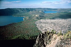
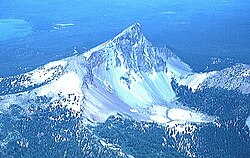
Mount Jefferson's eastern segment lies within the Warm Springs Indian Reservation, and its western portion within the Mount Jefferson Wilderness, of the Willamette National Forest and Deschutes National Forests. The wilderness area covers 111,177 acres (449.92 km2), with more than 150 lakes. It also has 190 miles (310 km) of trails, including 40 miles (64 km) of the Pacific Crest National Scenic Trail. Mount Jefferson is the major feature of the wilderness, along with the nearby Three Fingered Jack volcano.
Physical geography
Mount Jefferson lies in the temperate maritime climate of Western Oregon. The Cascades absorb east-moving moisture, causing warm and dry summers. Winters show higher precipitation levels, especially at higher elevations, averaging 140 to 160 inches (3,500 to 4,000 mm) at peak altitudes and consisting mostly of snow. Moving east, annual precipitation levels decrease from 98 inches (2,500 mm) to lower than 16 inches (400 mm).
When Little Ice Age glaciers retreated during the 20th century, water filled in the spaces left behind, forming moraine-dammed lakes, which are more common in the Mount Jefferson Wilderness and the nearby Three Sisters Wilderness than anywhere else in the contiguous United States. A number of these lakes breached during the 20th century and inundated Jefferson Park and the Jefferson Creek drainage under Waldo Glacier. These breach events yielded floods and small lahars (volcanically induced mudslides, landslides, and debris flows). The flood on August 21, 1934, at a lake formed near Whitewater Glacier, created a debris flow that reached the Whitewater River drainage and buried parts of Jefferson Park in 1 to 8 feet (0.30 to 2.44 m) of debris; another event took place in 1957, but was poorly documented.
Ecology
Vegetation at Mount Jefferson is dominated by Douglas fir, silver fir, mountain hemlock, ponderosa pine, lodgepole pine, and several species of cedar. Vine maple, rhododendron, purple lupine, yellow lupine, Indian paintbrush, wild strawberries, and red huckleberries are also common around Mount Jefferson. Above the timber line at 7,200 feet (2,200 m) above sea level, mountain hemlock and whitebark pine predominate, though mountain hemlock has also invaded into subalpine meadows at Mount Jefferson, possibly as a result of fire control programs, grazing, the influence of adjacent forest areas, and climate change.
Carnivorous animals at Mount Jefferson and its surroundings include American black bears, coyotes, cougars, red foxes, raccoons, American martens, stoats (also known as ermines), long-tailed weasels, American minks, North American river otters, and bobcats. Deer species include Roosevelt elk, black-tailed deer, and mule deer; insectivores include vagrant shrews, American water shrews, and coast moles. Bats at Jefferson include little brown bats and silver-haired bats, and American pikas and snowshoe hares are also present. Rodents such as yellow-bellied marmots, mountain beavers, yellow-pine chipmunks, Townsend's chipmunks, golden-mantled ground squirrels, western gray squirrels, Douglas squirrels, mountain pocket gophers, North American beavers, deer mice, bushy-tailed woodrats, water voles, Pacific jumping mice, and North American porcupines are present.
Birds at Jefferson include mallards, northern goshawks, sharp-shinned hawks, red-tailed hawks, dusky grouse, grey partridges, killdeer, spotted sandpipers, California gulls, band-tailed pigeons, great horned owls, mountain pygmy owls, common nighthawks, rufous hummingbirds, Northern flickers, pileated woodpeckers, yellow-bellied sapsuckers, hairy woodpeckers, and white-headed woodpeckers.
Geology
Mount Jefferson shows normal magnetic polarity, suggesting that it formed less than 730,000 years ago. Created by the subduction of the oceanic Juan de Fuca tectonic plate under the continental North American tectonic plate in an area where the Earth's crust is 25 to 28 miles (40 to 45 km) thick, it is part of the Oregon High Cascades, which are influenced by the movement of the North American Plate and the extension of its continental crust. These extensional processes formed grabens, or valley-like depressions between parallel fault lines, at the eastern boundary of the central Cascades, including a 4,000-foot (1,200 m) deep formation. Jefferson does not lie in one of these grabens, but these tectonic processes continue, albeit at a less dramatic rate. At their peak rates, the crustal extension and depression of the Cascades area caused eruption of the Minto Lavas, made of basalt, followed by the Santiam basalts, named for their movement into the North Santiam River valley, which they filled to depths of 600 feet (180 m). Though the Jefferson vicinity has produced andesitic and dacitic lavas for the past 5 to 6 million years, major volcanoes more than 50 miles (80 km) south of the area have erupted basaltic andesite.
The central Oregon Cascades are made up of Eocene to Quaternary volcanic, volcaniclastic, igneous, and sedimentary rock. Miocene and Pliocene volcanic and sedimentary rocks have been exposed in the Jefferson area, which also sits above lava flows, cinder material, and breccia from the High Cascades that formed during and after the Pliocene. Jefferson is the largest volcano in the Jefferson Reach, which forms the 47-mile (75 km) strip that makes up the northern part of the Oregon Cascade Range. Stretching from Frog Lake Buttes to South Cinder Peak, this segment consists of at least 175 Quaternary volcanoes. With a width of 16 miles (25 km), it differs from the adjacent northern segment of the Cascades, where volcanoes show a scattered distribution. Other unusual features of the Jefferson Reach include that the northernmost 19 miles (30 km) of the strip does not contain many volcanoes formed since the early Pleistocene and that it features a number of andesitic and dacitic volcanoes, which are unlike the many mafic (rich in magnesium and iron) shield volcanoes within the stretch.
以上摘自英文维基百科「Mount Jefferson (Oregon)」(有删节;去掉了表格、图片、参考文献和外部链接),按 CC BY-SA 4.0 使用。全文和最新版本请看原文。