舆图

资料
百科(英文)
这个词条没有中文维基百科条目,下面是英文维基百科的原文。
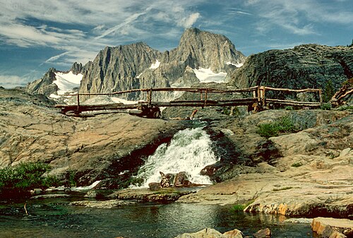
Mount Ritter is the highest mountain in Madera County, California, in the Western United States, at an elevation of 13,149 feet (4,008 m). It is also the highest and most prominent peak of its namesake, the Ritter Range, a subrange of the Sierra Nevada in the Ansel Adams Wilderness of the Inyo and Sierra National Forests. Mount Ritter is the 15th highest mountain peak in California with at least 500 meters of topographic prominence.
Geography
Mount Ritter is made of strikingly dark rock and is quite prominent due to its height and isolation. It is in the middle of the Ritter Range, which includes neighboring Banner Peak and the Minarets. The prominent and memorable shape of the Ritter–Banner pair is visible from high elevations far to the north and south in the Sierra Nevada.
Mount Ritter was named by Josiah Whitney, chief of the California Geological Survey, for Carl Ritter, who had been a teacher of his when he was a student in Berlin during the 1840s.
以上摘自英文维基百科「Mount Ritter」(去掉了表格、图片、参考文献和外部链接),按 CC BY-SA 4.0 使用。