舆图

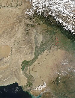
示意图,边界据 Natural Earth,不作为划界依据。
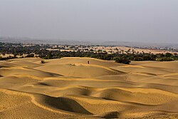
The Thal desert (Punjabi: تَھل صحرا, romanized: Thal Sahrā'h; Urdu: صحرائے تھل, romanized: Sehrā-é-Thal) is situated at 31°10' N and 71°30' E in the province of Punjab, Pakistan. Located near the Pothohar Plateau, the area falls under the Indomalayan biogeographic realm and stretches for a length of approximately 190 miles (310 km) with a maximum breadth of 70 miles (119 km). It is bound by the piedmont of the northern Salt Range, the Indus River floodplains in the west and the Jhelum and Chenab rivers' floodplains in the east. It is a subtropical sandy desert that resembles the deserts of Cho……
摘自英文维基百科「Thal Desert」,按 CC BY-SA 4.0 使用
资料
- 所在国家 / 地区
- 巴基斯坦
- 坐标
- 北纬 31.50°,东经 71.67°