舆图

资料
- 所在国家 / 地区
- 加拿大
- 坐标
- 北纬 66.67°,西经 102.82°
- 流出的河流
- Perry River
灰色斜体的是 Wikidata 里没有中文名的,照录英文名。
百科(英文)
这个词条没有中文维基百科条目,下面是英文维基百科的原文。
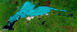
MacAlpine Lake is a lake in the Canadian territory of Nunavut.
Location
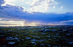
The lake is situated in a tundra landscape in northern Canada, 140 km (87 mi) south of the Arctic Ocean. The town of Baker Lake is located almost 400 km (250 mi) south-east of the lake. The water area is 421 km2 (163 sq mi), and with islands the total area is 447 km2 (173 sq mi).
The Perry River drains the lake northwards to the Queen Maud Gulf.
以上摘自英文维基百科「MacAlpine Lake」(去掉了表格、图片、参考文献和外部链接),按 CC BY-SA 4.0 使用。