舆图
拉特立尼达 城镇
La Trinidad · 科迪勒拉行政区
- 国家 / 地区
- 菲律宾
- 一级行政区
- 科迪勒拉行政区
- 坐标
- 北纬 16.45°,东经 120.59°

示意图,边界据 Natural Earth,不作为划界依据。
更多资料
- 人口(Wikidata)
- 142,925(2024 年)
- 面积
- 70.0 平方千米
- 海拔(Wikidata)
- 1,102 米
- 所属行政区
- 本格特省
- 设立
- 1950 年
- 邮政编码
- 2601
- 电话区号
- 74
- 邻接
- 图布莱
- 友好城市
- 宫古市、常陆太田市
人口变化
| 年份 | 人口 | 较上一次 | |
|---|---|---|---|
| 1903 | 267 | ||
| 1918 | 3,013 | +1028.5% | |
| 1939 | 6,554 | +117.5% | |
| 1948 | 7,994 | +22.0% | |
| 1960 | 12,415 | +55.3% | |
| 1970 | 18,551 | +49.4% | |
| 1975 | 22,732 | +22.5% | |
| 1980 | 28,713 | +26.3% | |
| 1990 | 48,523 | +69.0% | |
| 1995 | 63,089 | +30.0% | |
| 2000 | 67,963 | +7.7% | |
| 2007 | 97,810 | +43.9% | |
| 2010 | 107,188 | +9.6% | |
| 2015 | 129,133 | +20.5% | |
| 2020 | 137,404 | +6.4% | |
| 2024 | 142,925 | +4.0% |
Wikidata 记录的历次人口数(普查和估计混在一起,口径可能不同)。
百科(英文)
这个词条没有中文维基百科条目,下面是英文维基百科的原文。
La Trinidad ([lɐ tɾinɪˈdɐd]), officially the Municipality of La Trinidad (Ilocano: Ili ti La Trinidad; Tagalog: Bayan ng La Trinidad), is a municipality and capital of the province of Benguet, Philippines. According to the 2024 census, it has a population of 142,925 people.
The town is known for its strawberry fields, earning the title "Strawberry Fields of the Philippines". The municipality is within the Metro Baguio area.
Etymology
The town's name is the Spanish La Trinidad, referring to the Most Blessed Trinity.
History
Spanish period
The valley encompassing La Trinidad was originally called "Benguet", a thriving community of Ibaloi migrants from Tinek. Natives traded local products, which included gold, with nearby lowland towns that already had Dominican and Augustinian missions established. In around 1616, Procurator-General of Manila, Hernándo de los Ríos Coronel, became interested in the mountains' gold and proposed to expedite its search to King Philip IV of Spain. He wrote in December 1618 to both Alonso Fajardo, the Governor of Manila, and Miguel García Serrano, the Archbishop of Manila, that it was the solution to both the abandoned missions as well as the depleted colonial treasury. Fajardo requested feedback from the religious orders on this matter; whether waging a war against the Igorots was just. Only the Jesuits objected to the war, preferring only that their "mines be occupied in the name of His Majesty".
In 1620, Fajardo sent the first expedition under Captain García Aldana y Cabrera, Governor of Pangasinan. Aldana and his men took the route from Aringay, crossing the Naguilian River to Duplas (now in La Union), then followed the Bornotan (Santo Rosario) River eventually reaching Takdian. Upon arriving at the mining community of Bua, the men found only a recently burned village, suggesting the natives fled with nothing for them to plunder. Aldana examined the Antamok mines and was able to gather some gold.
A second expedition was sent in 1623 under the command of Sergeant Major Antonio Carreño de Valdés. Carreño was able to repel some Igorot assaults, building two forts; 'Fort Santiago' overlooking the present Santo Nino mines, and 'Fort del Rosario' in the Antamok-Itogon area. The Igorots submitted to Spanish authorities, only to strike back when the rainy season made it difficult to send manpower and new supplies, prompting the Spaniards to retreat.
Finally, in 1624, Fajardo sent Captain Alonso Martín Quirante, a master of strategy, logistics and tactics. In February of that year, Quirante took off with a huge expedition of 1,903 soldiers, carpenters, miners, smiths, slaves, clerks and some requisite clergy. He divided his large force into three; the first to clear the road, the second to follow, and the third with rations and arms. This ensured they would reach the mining area after clearing out an Igorot fort along the way. Quirante was able to reach the mining areas, and discovered about two hundred abandoned houses, implying the locals fled beforehand. He rebuilt Fort Santiago, and examined five mines, four of which showed signs of having been abandoned by the Igorots: Arisey Bugayona, Baranaban, Antamog, and Conog. The fifth mine called Galan was still operational. Quirante ordered baskets of ore gathered from each mine, labeled and ready for assaying. The results showed no evidence of deposits rich enough to yield attractive profit, prompting Quirante to return to Manila with 400 baskets of ore to be sent to Mexico for further assaying.
Meanwhile, the Real Audiencia had become concerned at the expense of the project which had already cost 33,982 pesos. Don Gerónimo Silva took over the government, convening the council to decide on the issue. The Real Audiencia decided to abandon the project because of mounting expenses, loss of life and the continued hostility of the Igorots and their land.
In 1829, another expedition was sent to Benguet under Guillermo Galvey.
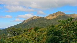
Although the District of Benguet was established in La Trinidad by 1846, it was only on April 21, 1874, under Commandant Manuel Scheidnagel, the Valle de Benguet was renamed Valle de La Trinidad (La Trinidad Valley). Despite popular acceptance that it was named as "a fitting tribute to Galvey’s wife - Doña Trinidad de Galvey" – recent research has revealed that credit should have probably gone to Scheidnagel, having been inspired by the three prominent adjacent hills evoking the Holy Trinity overlooking the Población church, where the Cabecera (seat of government) was established.
Geography
La Trinidad is located at 16°28′N 120°35′E, at the central portion of Benguet. It is bounded by Tublay on the north-east, Sablan on the west, Baguio on the south, Itogon on the southeast, and Tuba on the south-west.
According to the Philippine Statistics Authority, the municipality has a land area of 70.04 square kilometres (27.04 sq mi) constituting 2.53% of the 2,769.08-square-kilometre- (1,069.15 sq mi) total area of Benguet.
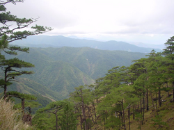
The terrain is generally mountainous with springs, rivers and creeks. The town has a valley which encompasses several barangays. The valley floor elevation is at 1,300 metres (4,300 ft) above sea level. Elevation ranges from 500 to 1,700 metres (1,600 to 5,600 ft) above sea level.
The Balili River is the municipality's main water drainage which carries upstream water from the Sagudin River in Baguio. The river merges with another upstream river in Tuel upon reaching the La Trinidad-Tublay-Sablan tri-point.
La Trinidad is situated 253.91 kilometres (157.77 mi) from the country's capital city of Manila.
Climate
La Trinidad has a dry-winter subtropical highland climate (Köppen climate classification: Cwb), featuring a menacing wet season.
La Trinidad belongs under the Type I climate by the Coronas System of classification with distinct wet and dry seasons. The dry season lasts from November to April, while the wet season occurs during the rest of the year. The climate is cool, with temperatures ranging from 11.7 °C (53.1 °F) during the month of December at its coldest and 23.2 °C (73.8 °F) at its warmest during the months of March, April and May. The average daily temperature is 18.55 °C (65.39 °F), and its wind velocity is 1.43. During the rainiest month of August, the rainfall average is 850.70 millimetres (33.492 in).
Barangays
La Trinidad is politically subdivided into 16 barangays., with 11 classified as urban and 5 as rural. Each barangay consists of puroks and some have sitios.
As of 2015, the most populous is Pico with 23,282 people, while Bineng, with 1,624 people, has the least. Wangal is the largest in terms of land area, while Cruz is the smallest. Balili was the most densely populated, and Bineng was the least. Bineng has the most number of sitios, while Betag has the least with only 4.
Demographics
In the 2024 census, La Trinidad had a population of 142,925 people. The population density was 2,000 inhabitants per square kilometre (5,200/sq mi).
Languages
The residents of La Trinidad speak Ibaloi and Kankanaey. Ilocano is also used as a lingua franca in the municipality.
Economy
Poverty incidence of La Trinidad (%)
Source: Philippine Statistics Authority
La Trinidad supplies most of the Philippines' strawberries and cut flowers, which include roses. The La Trinidad Vegetable Trading Post is visited by wholesalers and traders of vegetables from other provinces. The presence of the Benguet State University in the municipality serves as a boost to agricultural research and development in the region.
The town landed on the Guinness Book of World Records for baking the world's largest strawberry shortcake, at 21,213.40 pounds (9,622.24 kg), at the La Trinidad Strawberry Festival on March 20, 2004.
Its proximity to the city of Baguio attracts tourists, primarily to the strawberry fields in the valley, and lesser to the Benguet Provincial Capitol and the Rose Gardens of barangay Bahong.
Government
Local government
La Trinidad, belonging to the lone congressional district of the province of Benguet, is governed by a mayor designated as its local chief executive and by a municipal council as its legislative body in accordance with the Local Government Code. The mayor, vice mayor, and the councilors are elected directly by the people through an election which is being held every three years.
Education
The La Trinidad Schools District Office governs all educational institutions within the municipality. It oversees the management and operations of all private and public, from primary to secondary schools. La Trinidad, aside from the adjacent city of Baguio, is the center of higher education in Benguet province.
Public schools
As of 2014, La Trinidad has 23 public elementary schools and 7 public secondary schools.
The main campus of Benguet State University, the first university in the province, is located in the municipality.
Private schools
There are 11 private schools according to the Department of Education - Schools Division of Benguet.
Notable personalities
La Trinidad is the burial place of:
Deodato Arellano (1844–1899), a Filipino patriot and one of the founders of the Katipunan.
Sister cities
Local
Danao, Bohol
Quezon City
以上摘自英文维基百科「La Trinidad, Benguet」(有删节;去掉了表格、图片、参考文献和外部链接),按 CC BY-SA 4.0 使用。全文和最新版本请看原文。