舆图

资料
百科(英文)
这个词条没有中文维基百科条目,下面是英文维基百科的原文。
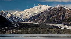
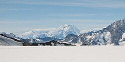
Mount Seattle is a 10,350-foot (3,150 m) peak in the Saint Elias Mountains on the border of Alaska, United States and Yukon, Canada. It was named for the city of Seattle, home of the "camp hands" of a 19th-century National Geographic Society–United States Geological Survey scientific expedition to the Hubbard Glacier and Mount Saint Elias. It is called the "most prominent Alaskan coastal peak" and blocks sight of larger inland peaks, even Mount Logan nearly twice its height.
It was first ascended in May 1966 by Fred Beckey, Eric Bjornstad and four other climbers.
以上摘自英文维基百科「Mount Seattle」(去掉了表格、图片、参考文献和外部链接),按 CC BY-SA 4.0 使用。