舆图

资料
- 所在国家 / 地区
- 加拿大
- 坐标
- 北纬 51.90°,西经 125.88°
- 所属山脉
- 太平洋山脉
- 地形孤立度
- 71.0 千米
百科(英文)
这个词条没有中文维基百科条目,下面是英文维基百科的原文。
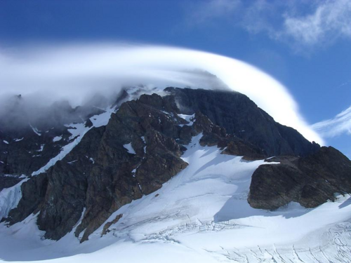
Monarch Mountain is one of the principal summits of the Pacific Ranges subdivision of the Coast Mountains in southern British Columbia. It stands just east of a pass between the Klinaklini River and the south branch of the Atnarko River, which is a tributary of the Bella Coola River. Surrounding Monarch Mountain is the Monarch Icefield, the northernmost of the major icefields of the Pacific Ranges, and just south of it is the Ha-Iltzuk Icefield, which is the largest. Monarch is in the southern end of Tweedsmuir South Provincial Park.
Climbing
The first ascent of the mountain was made on 16 July 1936 by Henry Snow Hall Jr. and Hans Fuhrer.
Climate
The summit of Monarch Mountain has an ice cap climate (EF).
以上摘自英文维基百科「Monarch Mountain (British Columbia)」(去掉了表格、图片、参考文献和外部链接),按 CC BY-SA 4.0 使用。