舆图

资料
- 所在国家 / 地区
- 加拿大
- 坐标
- 北纬 51.39°,西经 125.22°
- 所属山脉
- Waddington Range
百科(英文)
这个词条没有中文维基百科条目,下面是英文维基百科的原文。
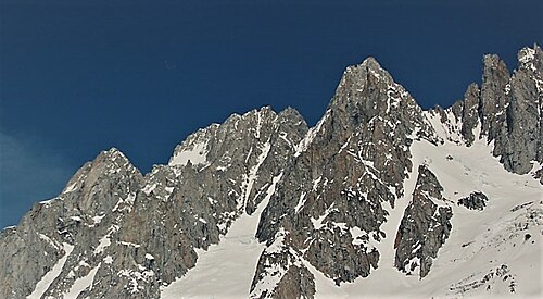
Asperity Mountain is a mountain located in British Columbia, Canada, rising to 3,723 metres (12,215 ft). It is located between Tellot and Tiedemann Glaciers on the north and south respectively, in the Waddington Range, a subrange of the Pacific Ranges. The gorge of the Homathko River runs north to south on the east side of the mountain, carrying runoff from the mountain and glaciers to the Pacific Ocean.
The term "Asperity", which the mountain takes its name from, refers to "unevenness of surface, roughness, ruggedness". The name was made official on February 23, 1978, although it was labeled as early as 1929 by Don Munday.
Asperity Mountain is described as being a "fine, high, sharp summit", with Mount Tiedemann to the west and the Serra Peaks bordering it on the east. Its south side is described as being rocky. There is an icefall to its north from the Radiant Glacier, a branch of the Tellot Glacier.
以上摘自英文维基百科「Asperity Mountain」(去掉了表格、图片、参考文献和外部链接),按 CC BY-SA 4.0 使用。