舆图

资料
- 所在国家 / 地区
- 加拿大
- 坐标
- 北纬 57.78°,西经 132.34°
- 所属山脉
- 边界山脉
百科(英文)
这个词条没有中文维基百科条目,下面是英文维基百科的原文。
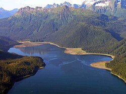
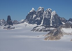
Chutine Peak is one of the highest mountains in the Boundary Ranges, a group of subranges of the northern Coast Mountains of British Columbia and Alaska. Chutine Peak lies just east of the Stikine Icecap, and to the north and west of the Stikine River, and south of the basin of the Whiting River. It is notable for its huge west face: the drop to Chutine Lake is 2,600 m (8,530 ft) in 3.5 km (2 mi). Due to its remoteness, however, it is rarely visited.
The mountain was named in 1980 by the first ascent party for its location near Chutine Lake and Chutine River. Chutine means "the half-people" - half Tlingit and half Tahltan
以上摘自英文维基百科「Chutine Peak」(去掉了表格、图片、参考文献和外部链接),按 CC BY-SA 4.0 使用。