舆图

资料
百科(英文)
这个词条没有中文维基百科条目,下面是英文维基百科的原文。
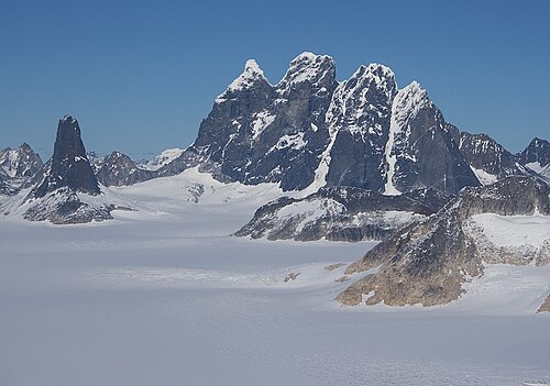
Devils Paw (or Devil's Paw, or Boundary Peak 93) is the high point of the Juneau Icefield, on the Alaska–British Columbia border. It is a part of the Boundary Ranges of the Coast Mountains. It is notable for its steep rise above the low local terrain. Its height is sometimes given as 8,507 feet (2,593 m).
Devils Paw is located on the northeast side of the Juneau Icefield, and its north slopes feed Tulsequah Lake and the Tulsequah Glacier. Its south slope forms the head of the picturesquely-named "Hades Highway", which is the eastern extremity of the Icefield.
To illustrate the steepness of the peak: the north face drops 7,000 ft (2,130 m) in approximately three miles (4.8 km), and the southeast side drops 8,000 ft (2,440 m) in about seven miles (11 km).
Climate
Based on the Köppen climate classification, Devils Paw is located in a subpolar oceanic climate zone, with long, cold, snowy winters, and cool summers. Temperatures can drop below −20 °C with wind chill factors below −30 °C.
以上摘自英文维基百科「Devils Paw」(去掉了表格、图片、参考文献和外部链接),按 CC BY-SA 4.0 使用。