舆图

资料
- 所在国家 / 地区
- 美国
- 坐标
- 北纬 38.07°,西经 107.46°
- 所属山脉
- 圣胡安山脉
- 所在保护区
- 安肯帕格里国家森林
百科(英文)
这个词条没有中文维基百科条目,下面是英文维基百科的原文。
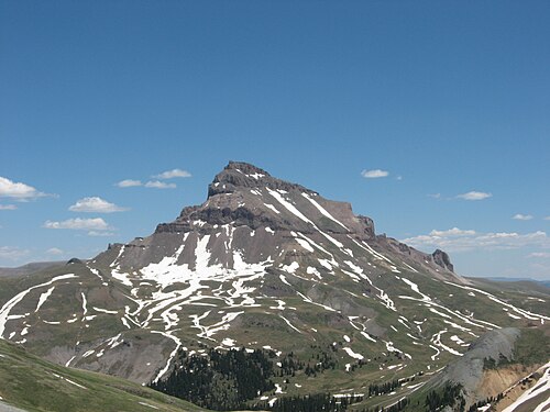
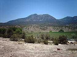
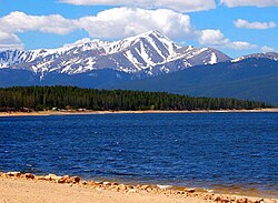
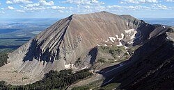
Uncompahgre Peak is the sixth highest summit of the Rocky Mountains of North America and the U.S. state of Colorado. The prominent 14,316-foot (4363.46 m) fourteener is the highest summit of the San Juan Mountains and the highest point in the drainage basin of the Colorado River and the Gulf of California. It is located in the Uncompahgre Wilderness in the northern San Juans, in northern Hinsdale County approximately 7 miles (11 km) west of the town of Lake City.
Uncompahgre Peak has a broad summit plateau, rising about 1,500 ft (500 m) above the broad surrounding alpine basins. The south, east and west sides are not particularly steep, but the north face has a 700 ft (210 m) cliff. Like all peaks in the San Juan Mountains, Uncompahgre is of volcanic origin, but is not a volcano. The rock is of poor quality for climbing, precluding an ascent of the north face.
The most popular route for climbing Uncompahgre Peak is Uncompahgre National Forest Service Trail Number 239, which starts from the end of the Nellie Creek Road, east-southeast of the peak. The Nellie Creek Road is a four wheel drive road accessed from the Henson Creek Road, about 4 miles (6.4 km) west of Lake City. The trail to the summit is a strenuous hike rising 2,919 ft (890 m) in elevation in about 3.5 mi (6 km). It accesses the summit in a winding ascent, starting from the east, passing over a south-trending ridge, and finishing on the west slopes of the summit plateau.
There is also a route up Uncompahgre starting at the Matterhorn Creek trailhead. It is popular among hikers preferring to avoid the 4wd Nellie Creek road.
The peak's name comes from the Ute word Uncompaghre, which loosely translates to "dirty water" or "red water spring" and is likely a reference to the many hot springs in the vicinity of Ouray, Colorado.
Over several days beginning on September 10, 1894, a detachment of the U.S. Army Signal Corps established the world heliograph record from stations atop Mount Ellen, Utah and Mount Uncompahgre, Colorado. The record for visual signaling was established utilizing mirrors 8 inches across and telescopes. The flashing signals communicated over a distance of 183 miles.
Historical names
Mount Chauvenet - 1873
Unca-pah-gre Mountain
Uncompahgre Mountain
Uncompahgre Peak – 1907
以上摘自英文维基百科「Uncompahgre Peak」(去掉了表格、图片、参考文献和外部链接),按 CC BY-SA 4.0 使用。