舆图

资料
- 所在国家 / 地区
- 美国
- 坐标
- 北纬 40.04°,西经 122.86°
- 所属山脉
- 加利福尼亚州海岸山脉
- 所在保护区
- Yolla Bolly-Middle Eel Wilderness
百科(英文)
这个词条没有中文维基百科条目,下面是英文维基百科的原文。
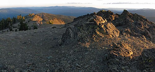
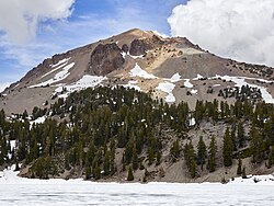
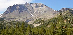
Mount Linn, at 8,098 feet (2,468 m), is the easternmost summit of South Yolla Bolly Mountain, and is located in the Yolla Bolly Mountains of the Northern Coast Ranges and sibling Klamath Mountains System, in Tehama County, northwestern California. Mt. Linn is the highest peak in the northern California Coast Ranges south of the Trinity Alps and, along with the highest peaks of the Trinity Alps, the tallest coastal range peak within the coterminous forty-eight states. Mt. Linn is the third most prominent peak in the northern Pacific Coast Ranges behind Mt. Eddy and Caesar Peaks in the Trinity Alps and Mt. Olympus of Washington's Olympic Mountains.
Mt. Linn is protected within the Yolla Bolly-Middle Eel Wilderness, in the Shasta-Trinity National Forest section.
Geography
The summit of Mount Linn is the highest point in the Northern California Coast Ranges segment of the Coastal Crest, south of the Trinity Alps range's high peaks, also in the Klamath Mountains System. The elevation of the mountain ensures it receives heavy winter snowfall and it has low average annual temperature near the summit.
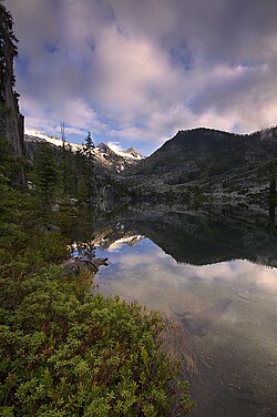
A tarn named Square Lake is located in a cirque on Mount Linn's north slope.
The cirque was carved by glaciers during the Ice Age.
The mountain was named by John C. Frémont in honor of Lewis F. Linn, a senator from Missouri, who played an important role in the acquisition of the Oregon Territory.
以上摘自英文维基百科「Mount Linn」(去掉了表格、图片、参考文献和外部链接),按 CC BY-SA 4.0 使用。