舆图

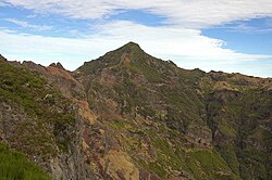
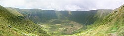
Serra de Santa Bárbara is the peak of an dormant volcano in the western part of the island of Terceira, Azores, Portugal. At 1,021 m (3,350 ft) elevation, it is the highest point of the island. It is named after the village located on the coast to the south, Santa Bárbara in the municipality of Angra do Heroísmo.
摘自英文维基百科「Serra de Santa Bárbara」,按 CC BY-SA 4.0 使用
资料
- 所在国家 / 地区
- 葡萄牙
- 坐标
- 北纬 38.73°,西经 27.32°
- 所属山脉
- 特塞拉裂谷