舆图

资料
- 所在国家 / 地区
- 加拿大
- 坐标
- 北纬 53.02°,西经 126.64°
- 所属山脉
- Kitimat Ranges
- 所处地形
- Kitimat Ranges
- 属于
- Kitimat Ranges
百科(英文)
这个词条没有中文维基百科条目,下面是英文维基百科的原文。
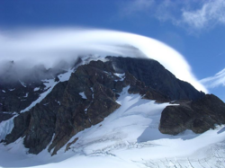
Tsaydaychuz Peak, 2758 m (9049 feet), prominence below Howson Peak is 1826 m, is a mountain in the Pattullo Range of the Hazelton Mountains, the southernmost subdivision of the Northern Interior Mountains system of the British Columbia Interior. The Pattullo Range, of which Tsaydaychuz is the highest summit, is located south of Tesla and Eutsuk Lakes and to the north of the Dean River. To its east is the Nechako Plateau. The first ascent of this peak occurred on 3 September 1978 by Glenn Woodsworth and Carol Evenchick using the Southeast ridge route.
以上摘自英文维基百科「Tsaydaychuz Peak」(去掉了表格、图片、参考文献和外部链接),按 CC BY-SA 4.0 使用。