舆图

资料
百科(英文)
这个词条没有中文维基百科条目,下面是英文维基百科的原文。
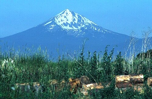
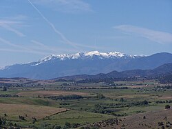
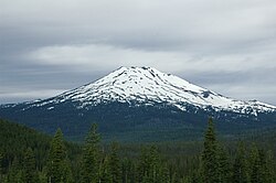
Mount McLoughlin is a 9,493 ft (2,893 m) dormant steep-sided stratovolcano, or composite volcano, in the Cascade Range of southern Oregon, United States. Located in the Sky Lakes Wilderness, it is one of the volcanic peaks in the Cascade Volcanic Arc, within the High Cascades sector. A prominent landmark for the Rogue River Valley, the mountain is north of Mount Shasta, and south-southwest of Crater Lake. It was named around 1838 after John McLoughlin, a Chief Factor for the Hudson's Bay Company. Mount McLoughlin's prominence has made it a landmark to Native Americans and others for thousands of years.
McLoughlin consists largely of basaltic andesite. It underwent three major eruptive periods before its last activity took place between 30,000 and 20,000 years ago. It is not currently monitored for activity or deformation. Diverse species of flora and fauna inhabit the area, which is subject to frequent snowfall and temperature variation between seasons. The Pacific Crest Trail skirts the eastern and northern sides and also accesses the only trail to the summit, the 6-mile (9.7 km) McLoughlin Trail 3716. The mountain can also be skied.
Geography
The major landmark for the Rogue River Valley, Mount McLoughlin reaches an elevation of 9,493 ft (2,893 m).[a] The tallest volcano in between Mount Shasta — located 70 mi (110 km) to the south — and South Sister 120 miles (190 km) to the north, it lies in the Cascade Range, in the southern portion of the U.S. state of Oregon. Most of the volcano lies in Jackson County, though the eastern side of its base lies in Klamath County. It is the sixth tallest peak in Oregon, but despite its height, Mount McLoughlin only has a volume of 3 cu mi (13 km3).
The volcano includes the Wilámxa Tip and Máalsi Tip peaks, which occur on its flanks at elevations of
7,179 ft (2,188 m) and
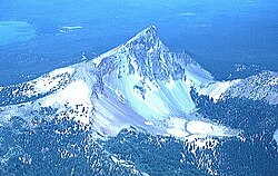
7,638 feet (2,328 m), respectively. It can be seen from the Interstate 5 and U.S. Route 97 highways. From the southwest and southeast, it has a symmetrical appearance, but the northeastern flank of the volcano has been eroded and transformed into a hollow amphitheater.
Wilderness
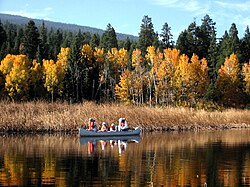
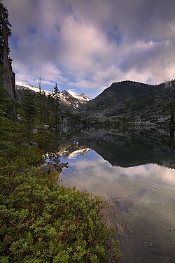
McLoughlin lies within the Sky Lakes Wilderness area, part of the Rogue River–Siskiyou and the Fremont–Winema National Forests. The Sky Lakes Wilderness covers an area of 113,590 acres (459.7 km2), with a width of 6 mi (9.7 km) and a length of 27 mi (43 km). Designated by the U.S.
Physical geography
The local area has warm, dry summers during the daytime with cool nights, and snowy winters that impede access to the Sky Lakes Wilderness through July.
Ecology
About 20 tree species can be found throughout Mount McLoughlin's surroundings, including Pacific yew at low elevations, mountain hemlock, whitebark pine, and subalpine fir at higher elevations, and lodgepole pine and red fir throughout. Other plant species include shrubs, wildflowers, junipers, heather, columbine, kinnikinnick, huckleberry, chinquapins, grouse huckleberry, and bearberry.
Common fauna in the area include chipmunks, deer, elk, American black bears, coyotes, while yellow-bellied marmots, fishers, pikas, and American martens are less common. More than 150 bird species live in the Big Butte Creek watershed near McLoughlin. Eagles and hawks can be sighted in the vicinity, as can spotted owls. goshawks like to live beneath the tree canopy in the region. Amphibian species like Oregon spotted frogs and Cascades frogs live in certain parts of the watershed. Fish species include Chinook salmon, rainbow trout, Coho salmon, Pacific lamprey, and coastal cutthroat trout.
Geology
Little was known about Mount McLoughlin's geology until the 1970s. Much of what is known today comes from LeRoy Maynard of the center for Volcanology at the University of Oregon. His work established that the volcano was built over three eruptive phases, each with their own eruption types. James Smith from the United States Geological Survey expanded on Maynard's findings, producing a map of the McLoughlin region.
McLoughlin is part of the High Cascades, which trend north–south. Formed towards the end of the Pleistocene Epoch, these mountains are underlain by more ancient volcanoes that subsided due to parallel north–south faulting in the surrounding region. Like other Cascade volcanoes, Mount McLoughlin was fed by magma chambers produced by the subduction of the Juan de Fuca tectonic plate under the western edge of the North American tectonic plate. Within Oregon, plutons, or bodies of intrusive igneous rock that crystallize from magma cooling below the surface of the Earth, lay between 47 and 68 mi (75 and 110 km) northwest of the major High Cascade axis. At McLoughlin, mean displacement rates for the past 16 million years have been 0.14 to 0.28 in (3.5 to 7.1 mm) each year.
The volcano shows magnetic high points to the east of its main cone, suggesting that it has normal magnetic polarization that corresponds to an age of less than 700,000 years.
Eruptive history
Mount McLoughlin underwent at least three distinct eruptive phases. Early activity at Mount McLoughlin was explosive, and it yielded tephra and pyroclastic rock that built about a third of the overall volume. These eruptions also yielded lava flows, but they only occurred on the lower flanks. The northwestern flank has volcanic vents that produced lava flows responsible for inundating the Fourbit Creek valley 4 mi (6.4 km) from the base of McLoughlin, which extend up to the Big Butte Springs. Other lava flows from earlier eruptions reach at least 6 mi (9.7 km) from the base of the mountain, a number of which run along the Oregon Route 140 highway. One ʻaʻā stream that filled a river valley for 6 mi (9.7 km) in length moved from an elevation of 5,000 ft (1,500 m) to 3,000 ft (910 m), though it was thin, with more than 2.5 mi (4.0 km) of its length being less than 500 ft (150 m) in width.
A second eruptive stage was characterized by large lava flows, which covered the inner pyroclastic core with basaltic andesite. These thin lava flows formed a shell around the loosely compacted pyroclastic interior. The third stage of development consisted of floods of blocky lava erupting from below the summit and more fluid lavas erupting from basal fissures, mostly confined to the south slope.
Human history
McLouglin has served as a landmark to Native American populations and others for thousands of years. Indigenous peoples utilized the area to hunt and gather berries. The Takelma people referred to it as "Mal-sr" or "Alwilamchaldis", one of their mythical heroes, and they considered it the home of Tasuune, or the "Acorn Woman", a being that helped their acorns grow every year. In the culture of the Shasta people, McLoughlin was known as "Makayax"; the Klamath people named the volcano "Walum" and "Kesh yainatat", meaning the home of the "dwarf old woman" that controlled the west wind. McLoughlin was called "Melaiksi" by the Modoc people. The Little Butte Creek which drains from McLoughlin was called "So-ytanak", translating as "corner" or "rock house", by the Upper Takelma people.
First detected by an American explorer Peter Skene Ogden in 1827, McLoughlin has a complex name-place history. Ogden called the volcano "Mt. Sastise" after the Shasta Native Americans that helped him reach the Rogue Valley; this name was later exchanged with Mount Shasta in northern California, then called "Pit Mountain". To local residents, Mount McLoughlin's English name was Mount Pitt, though it came to be referred to by other names including Mt. John Quincy Adams, Mt. Clear View, Snowy Butte, and Mt. Madison, also appearing in maps as Mount Pitt, Mount Simpson, and Mount Jackson.
Recreation
Mount McLoughlin has a 5-mile (8.0 km) hiking trail to its summit, a six hour round-trip which gains about 4,000 feet (1,200 m) in elevation. While the route receives moderate to heavy use each year, ascent to the peak is easiest from July through September, when the trailhead is accessible by vehicle and snow is minimal along the path. Although there is a creek crossing at the beginning of the trail that currently requires walking across a log or wading through the water until a new bridge is built.
The Mt. McLoughlin Trailhead is on Forest Road 3650, 2.5 miles (4.0 km) north of Oregon Route 140. After about 1 mile (1.6 km), the Mt. McLoughlin Trail joins the Pacific Crest Trail for half a mile, then passes through a forested area for about 2.5 miles (4.0 km) before reaching timberline. The last mile of the route travels over blocky lava and rubble, and the trail above the tree line is less clearly delineated. From the summit, Mount Shasta and Crater Lake can be seen.
During the winter, the climb requires snowshoes, crampons, and ice axes, and is far more challenging than the popular summertime route. The access road from Oregon Route 140 may also be closed due to snow, requiring a longer approach on snowshoes or cross country skis. The mountain can also be skied, which has become more popular in recent years.
以上摘自英文维基百科「Mount McLoughlin」(有删节;去掉了表格、图片、参考文献和外部链接),按 CC BY-SA 4.0 使用。全文和最新版本请看原文。