舆图

资料
- 所在国家 / 地区
- 加拿大
- 坐标
- 北纬 51.15°,西经 117.42°
- 所属山脉
- 塞尔扣克山脉
- 所在保护区
- 冰川国家公园
- 母峰
- Mount Sir Sandford
- 得名自
- 乔治·道森
百科(英文)
这个词条没有中文维基百科条目,下面是英文维基百科的原文。
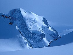
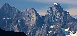
Mount Dawson, elevation 3,377 metres (11,079 ft), is a massif in the Selkirk Mountains of British Columbia, Canada, located in Glacier National Park to the southeast of Rogers Pass. It is a double summit, the highest of which is Hasler Peak, the second peak being Feuz Peak, with Hasler Peak's elevation making it the highest summit in Glacier National Park and the second highest in the Selkirks. Mount Dawson is ranked as the 58th highest mountain in British Columbia. The Dawson Glacier is located on its eastern flank.
Name
Mount Dawson was named 1888 by Reverend W.S. Green for geologist George Mercer Dawson (1846–1901), member of the British North America International Boundary Commission, 1873, later director of the Geological Survey of Canada (1895–1901).
Climate
Based on the Köppen climate classification, Mount Dawson is located in a subarctic climate zone with cold, snowy winters, and mild summers. Temperatures can drop below −20 °C with wind chill factors below −30 °C.
以上摘自英文维基百科「Mount Dawson (Canada)」(去掉了表格、图片、参考文献和外部链接),按 CC BY-SA 4.0 使用。