舆图

资料
- 所在国家 / 地区
- 加拿大
- 坐标
- 北纬 50.07°,西经 115.58°
- 所属山脉
- Kootenay Ranges
- 所处地形
- Kootenay Ranges
- 属于
- Kootenay Ranges
百科(英文)
这个词条没有中文维基百科条目,下面是英文维基百科的原文。
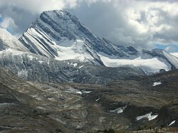
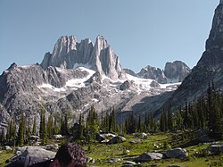
Shark Tooth Mountain, officially named in 1954, is also known as The Sharktooth or Sharp Tooth Mountain. It is a mountain in the East Kootenay region of southeastern British Columbia, Canada, southwest of Whiteswan Lake. Presumably, the name is related to the profile of the peak. It sits to the southwest of Whiteswan Lake Provincial Park, with Lussier Hot Springs and Ram Creek Hot Springs nearby, and is part of the Kootenay Ranges subdivision of the Canadian Rockies in Western Alberta and most of British Columbia.
以上摘自英文维基百科「Shark Tooth Mountain (British Columbia)」(去掉了表格、图片、参考文献和外部链接),按 CC BY-SA 4.0 使用。