舆图

资料
- 所在国家 / 地区
- 加拿大
- 坐标
- 北纬 55.54°,西经 127.49°
- 所属山脉
- Babine Range
百科(英文)
这个词条没有中文维基百科条目,下面是英文维基百科的原文。
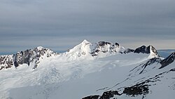
Mount Thomlinson is a mountain in the Babine Range of the Skeena Mountains in northern British Columbia, Canada, located at the head of Thomlinson Creek, southeast of the junction of Babine River and Skeena River and north of Hazelton. It has a prominence of 1,661 m (5,449 ft), created by the Babine-Stuart Pass, thus making it one of Canada's many Ultra peaks. Thomlinson is one of the most isolated mountains of Canada.
以上摘自英文维基百科「Mount Thomlinson」(去掉了表格、图片、参考文献和外部链接),按 CC BY-SA 4.0 使用。