舆图

资料
- 所在国家 / 地区
- 加拿大
- 坐标
- 北纬 54.42°,西经 127.74°
- 所属山脉
- Howson Range
百科(英文)
这个词条没有中文维基百科条目,下面是英文维基百科的原文。
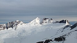
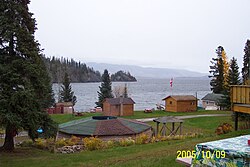
Howson Peak is a mountain in west central British Columbia, Canada, located 54 km (34 mi) southwest of Telkwa, southwest of the head of Telkwa River, and near the Burnie River and Kitnayakwa River tributaries of the Zymoetz River. This prominent mountain is the highest of the Howson Range. Howson Peak was first climbed in 1958 after an accident during a 1957 attempt in which Rex Gibson, then president of the Alpine Club of Canada, was killed. That route, as well as many other lines, remains unclimbed. The mountain is now in Tazdli Wiyez Bin or Burnie-Shea Provincial Park. Access is by air to Burnie Lake or on foot from the Kitnayakwa River road. The Burnie Glacier Chalet is the nearest accommodation.
以上摘自英文维基百科「Howson Peak」(去掉了表格、图片、参考文献和外部链接),按 CC BY-SA 4.0 使用。