舆图
贝尼托·胡亚雷斯区 城镇
Benito Juarez · 墨西哥城
- 国家 / 地区
- 墨西哥
- 一级行政区
- 墨西哥城
- 坐标
- 北纬 19.40°,西经 99.16°

示意图,边界据 Natural Earth,不作为划界依据。
更多资料
- 人口(Wikidata)
- 434,153(2020 年)
- 面积
- 26.6 平方千米
- 海拔(Wikidata)
- 2,242 米
- 所属行政区
- 墨西哥城
- 设立
- 1941 年
- 得名自
- 贝尼托·华雷斯
- 政府首脑
- Luis Mendoza Acevedo
百科(英文)
这个词条没有中文维基百科条目,下面是英文维基百科的原文。
Benito Juárez (Spanish: [beˈnito ˈxwaɾes] ), is a borough (demarcación territorial) in Mexico City. It is a largely residential area, located to the south of historic center of Mexico City, although there are pressures for areas to convert to commercial use. It was named after Benito Juárez, president in the 19th century.
The borough has the highest socioeconomic index in the country as it is primarily populated by the middle- and upper-middle classes. The borough is home to a number of landmarks such as the World Trade Center Mexico City, the Estadio Azul, the Plaza México and the Polyforum Cultural Siqueiros.
The borough
The borough is in the north center of Mexico City, just south of the oldest section of the city. It borders the boroughs of Miguel Hidalgo, Cuauhtémoc, Coyoacán, Iztapalapa, Iztacalco and Álvaro Obregón. The borders are formed by two rivers, the La Piedad and the Churubusco, as well as the following streets: Presidente Adolfo López Mateos (Anillo Periférico), 11 de Abril, Avenida Revolución, Puente de la Morena, Viaducto Miguel Alemán, Calzada de Tlalpan, Santa Anita, Atzayacatl, Plutarco Elías Calles and Barranca del Muerto. Many of the names of the rivers, streets and neighborhoods have their origin in the pre Hispanic period.
It has a territory of 26.63 km2 (2,661.5 hectares), which is 1.8% of Mexico City, with an average altitude of 2,242 metres. It consists of 56 neighborhoods called "colonias" and three major apartment complexes (unidades habitacionales) which cover 2,210 city blocks and through which some of the most important city thoroughfares pass. The borough is nearly entirely residential with a socioeconomic level of middle class to upper middle class.
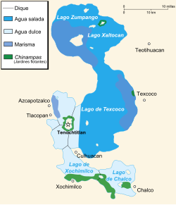
The borough is located in the southwest part of the Valley of Mexico. The land is flat with little variation and a portion of it is former lakebed of Lake Texcoco. The ground is highly elastic clay which extends down for about fifteen meters. The climate is temperate with an average annual temperature of 17C.
Most of the neighborhoods of the borough have a socioeconomic level of middle class to upper middle class. Forty two percent of the land is zoned for mixed use (residential/commercial), thirty nine percent residential, thirteen percent for storage and warehouses, four percent for open space and two percent industrial. Almost all housing and other construction consists of cement, cinderblock or brick, including both walls and roofs. The total number of housing units is 115,975, with 99.9% privately owned. The average number of people per household is 3.1. About 94% of housing is constructed in accordance to building codes. Housing units mostly consist of individual houses (27%), apartments in complexes (62%) and a housing arrangement called a "vecindad" (5%). Over 99% of residential units have running water, 99.5% have sewerage and 100% have electricity. The most important colonias are Nápoles, Del Valle, Narvarte, Mixcoac, Portales, Ciudad de los Deportes, San José Insurgentes, San Pedro de los Pinos, Xoco, Insurgentes Mixcoac, General Anaya, Noche Buena and Nativitas.
Landmarks
The World Trade Center is located in Colonia Nápoles. It was a development project conceived in 1947, in an area called Parque de la Lama. However, political opposition stalled the project until the 1960s. At this time, in preparation for the 1968 Olympics, the project moved forward with a total eleven spaces centered on the Hotel de México building. This complex includes the Polyforum, a commercial center, a Public Art school, a handcrafts market, a dinner theatre, garden areas, parking garage and a public transportation hub.
History
Name and symbol
The borough was created in 1970 and named after former Mexican president Benito Juárez. The current logo for the borough was adopted in 2001, which is a stylized depiction of the head of President Benito Juárez. The prior logo was a glyph of a serpent which is symbolic of Mixcoac.
Archeology
The main archeological finds of the area are Aztec/Mexica and include those in Mixcoac, Actipan, Tlacoquemécatl, Xoco, Portales, Ticomán, La Piedad, Ahuehuatlan, Barrio de San Juan, San Pedro de los Pinos Acachinaco (Nativitas) and one at the Metro Zapata station. The pyramid base as San Pedro de los Pinos is located near Mixcoac. It is the only one of its kind left in the borough, discovered in 1916 by Francisco Fernández del Castillo. It was a Mexica temple dedicated to the god Mixcoatl. The site also contains two temazcals as well as two Teotihuacan style sculpted heads. Artifacts have been found in other areas as well such as Xoco and Santa Cruz which include ceramics, stone knives and figurines. In the former village of Atoyac, a pre-Hispanic idol was found during the colonial era and destroyed by the Spanish. The Spanish village was built over a Mesoamerican one, which was dedicated to Tlahuac. The church of Santa Cruz Atoyac was built over the temple.
Colonial period
Except for small villages on the east and west side, most of the territory of the modern borough was covered by the waters of Lake Texcoco during the pre-Hispanic period. Crossing part of the east side was a causeway that linked Tenochtitlan to Iztapalapa and Tlalpan. After the Spanish conquest of the Aztec Empire, the first colonial era constructions in the area were evangelical churches built by the Franciscans such as the Church of Santa Cruz in Atoyac in 1564 and the Santo Domingo de Guzmán Church in Mixcoac in 1595. In the early colonial period, most of the area came under the jurisdiction of Hernán Cortés as part of his Coyoacán properties. As Lake Texcoco dried, the area became dotted with villages under the hacienda system and had some important roads leading south from Mexico City. The old causeway became the Calzada de Tlalpan and would eventually become the first to be paved. In the Mixcoac area, villages dotted an important colonial era road that connected the main village of Mixcoac with Tacubaya. Other important roads included that with linked San Ángel to Tacubaya, called the Atlacuihuayan, today Avenida Revolución, and the road that linked village of La Piedad with Mexico City over which bricks and pulque was transported.
The Cortés family would lose their Coyoacán lands by the early 17th century but as the lake dried, the area remained a rural zone just south of Mexico City. This city would remain within its conquest-era boundaries for all of the colonial period into the 19th century, with the Spanish living in the city and the indigenous living in the rural areas outside. However, these indigenous lost control over lands they held previously. Whatever lands they still held communally would be eventually taken over by growing Spanish-held haciendas.
Demographics
The borough is currently one of the most densely populated in Mexico City with 16,260 inhabitants per km2, 1.3 times the density of Mexico City as a whole. During work days, another million and a half people come into the borough to work or shop. Most of the population of the borough occurred in the mid 20th century and since then there has been a slight negative growth rate starting at −2.9% in the 1980s to -.03% in 2005, although population increased again from 2010 to 2020. The most populous neighborhoods include Narvarte Oriente, Narvarte Poniente, Del Valle Centro, Portales Norte, Del Valle Norte, El Valle del Sur, Portales Sur and Álamos.
The population of the borough is slightly older than the Mexico City average, with the highest overall standard of living. The average age in Benito Juárez is 33 years compared to the city average of 27. Most of the population is in the middle to upper middle class, with about fifty two percent white collar workers and other professionals. According to the 2005 census, 32 percent work in services, 13% as street vendors and 12% as government workers. There are 122,000 residential units with 2.9 occupants on average. 99% are literate, average schooling is 12.6 years with 117,000 people with professional level studies and 16,000 with post-graduate degrees. The borough was ranked with the highest standard of living in the country of Mexico according to the Consejo Nacional de Población.
Most of the population of the borough originates from some other part of the country with a small population of indigenous language speakers. As of 2000, 69% of the population had migrated into the borough from other parts of Mexico, especially the states of Hidalgo, Puebla, Veracruz and Oaxaca. As of 2000, there were just under 6,000 people in the borough that spoke an indigenous language, about 1.8 percent of the total, with almost all of the rest being speakers of Spanish. This ranks the borough eighth in Mexico City. Of the indigenous language speakers, just under seventy percent were women and most spoke Nahuatl at 28.5% followed by Zapotec and Otomi at 11.5 and 9.4% each.
Economy
The borough's economic activity accounts for 6.2% of the total GDP of
以上摘自英文维基百科「Benito Juárez, Mexico City」(有删节;去掉了表格、图片、参考文献和外部链接),按 CC BY-SA 4.0 使用。全文和最新版本请看原文。